Walking the Wayfarers Walk from Basingstoke to Kingsclere
About 2 weeks earlier, on Friday August 7th, I cycled from home into Hatch Warren, and then to Beggarwood Lane, to find Long Copse Lane, and sure enough I found it, and found where the Wayfarers Walk meets Long Copse Lane, so now I knew how to walk the Wayfarers Walk from Basingstoke.
On Saturday 22nd August, 2020, about 0810, I left home, and walked to bus stop opposite the Railway Station, in Basingstoke. I was going to use the bus number 8 that goes to Kempshott & Beggarwood Lane, so I could then use a footpath to meet the Wayfarers Walk and then walk to Kingsclere.
I caught the bus number 8, that left the bus stop at 0910, and about 30 minutes later, I got off it on Beggarwood Lane, and then walked along a tarmac footpath to meet Long Copse Lane.

I then walked along Longwood Copse Lane, as indicated on a street sign-
The lane then converts into a gravelled footpath with the golf course to the right. Walking along the footpath, the noise of traffic indicated I was close to the M3-then I saw the waymark sign, showing the Wayfarers Route Mark pointing the way to the right, going next to the M3 on the left-hand side.

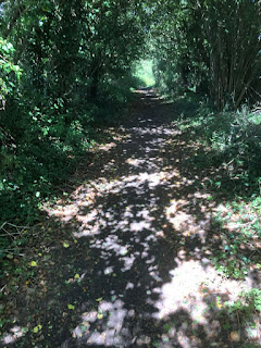
The path goes through some woods with lots of trees over hanging the path.
Eventually the path ends and the path goes over the A30 road which at this point is a dual carriageway with a grassy island in the middle of the carriageways.
So, the path goes over both carriageways, then, as according to a sign at the side of the road, I walked along the side of one of them on a grassy path, and then came to a crossing point over a side road to another minor road.
So, the path goes over both carriageways, then, as according to a sign at the side of the road, I walked along the side of one of them on a grassy path, and then came to a crossing point over a side road to another minor road.
Having crossed the road, I then walked along the right-hand side of the lane to reach an entrance to a path alongside a wood.
The path now goes alongside a wood, at the start is a grassy path, then later on becomes a track. At the bottom of a slope the track goes to the right, then goes left as indicated by waymark signs.

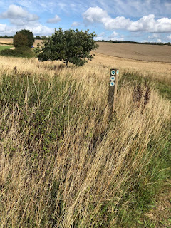
Then the path goes straight across a field, though signs seem to indicate it first goes through a small gap in the hedge blocked by a fallen tree, then a sign shows the route ahead.
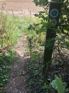
On reaching the other side of the field, the wayfarers walk goes to the right alongside another wood as indicated on this sign.

The actual route of the Wayfarers Walk is alongside the Copse, it goes from the sign post, and goes on a track.

and eventually comes to a gap in the woods, with a sign pointing the way.


The path then goes to the right, whereas to the left is a kissing gate, which goes into the woods, and a footpath sign indicating the alternative way through the woods to the other end of the track.
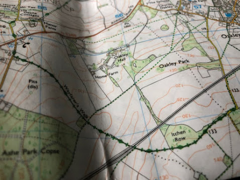
The OS map shows the footpath through the woods, having the Wayfarers Walk as the route through it as opposed to going around the woods.


The path goes beside the wood,
and comes to a cross roads of paths, with one going straight on towards Oakley, going over the Railway line from Basingstoke to Winchester. Another path goes to the right towards Kempshott, which I went on before going towards Pardown, and the other path going to the left, is the Wayfarers Walk going towards a lane from Oakley. All the paths are shown on the OS map as I have put in on this blog.
This sign on a wooden waymark post shows the way to the footpaths.
On the same map, above, the Wayfarers Walk is shown as going through Bull’s Bushes Copse.
You can see now, how it was that when I did this walk first of all, looking at my OS Map, 144, published in 2015, it shows the Wayfarers Walk, going through this wood called Bull’s Bushes Copse.
Having turned left at the crossroads of paths, the path goes next to the woods on a narrow path and also next to a track.
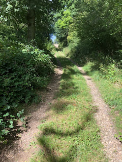
Then the Wayfarers Walk goes on a stony track, in the woods and comes out beside a tarmac track, then goes onto a track with the woods on the left and comes out onto a lane.


Then I walked on a track, which goes between the woods & the tarmac path,

and just before it reaches the lane coming from Oakley, there is the way into the woods, and signs indicating the Wayfarers Walk going on the footpath I was walking on and not through the woods.
So, I continued to walk along the Wayfarers Walk and came to the lane.
So now I looked at my OS map and saw where this lane came from and where it went. It came from Oakley, and goes to Dummer, and also to North Waltham, crossing the A30. Going to the right it goes to Oakley, going under the railway line between Basingstoke & Winchester.

Instead of walking along the lane, I saw that there was a footpath next to a fence, with a hedge line to the left of this footpath, which goes parallel with the lane.
The path becomes very much covered with vegetation, making it difficult to walk on so I had to leave it, walk onto the side of the road, and enter the track where I saw a signpost and the footpath which I had just been on. Work needs to be done to the footpath to make it safer and easier to walk on.
I need to look at the footpath sign to see if there is Wayfarers Walk sign on it, and walk along the footpath to check it out.
The signs on the fingerpost indicate the route is not along a footpath, but straight ahead along the lane, which I had just walked on.
I then walked along the Wayfarers Walk which goes from the lane to under the railway line and then down to the lane that goes between Steventon & Deane. The walk now is a track not a narrow footpath.
I soon reached the point where I had a break and lunch before, where I had seen the TV mast which is above Kingsclere in the distance.
The track goes down and under the railway line between Basingstoke & Winchester.
The path then goes uphill, and meets a signpost with a cross roads of footpaths.
Paths goes from left to right & straight on
The path going to the right goes to Oakley, whilst the one to the left goes to Steventon.
I walked straight on along Wayfarers Walk which went downhill to meet the lane that goes from Steventon to Deane, crossing the B3400,.
The map below shows the route of this Wayfarers Walk from the lane crossing the railway line and going over the B3400 road between Basingstoke & Whitchurch.
The path I was on which is a restricted by-way, goes down a stony path, and meets the lane which goes between Steventon & Deane.
On meeting this lane, I turned right, and walked along the lane and soon came to the road that goes between Basingstoke & Whitchurch called the B3400.
I crossed the B road, and then went along the lane next to Deane Church, and turned right.
At a road junction, where there are no signs at all to help walkers make the right decision as to where to go.
The OS Map helps walkers making that decision.
The Wayfarers Walk as seen on the map above, goes onto the lane near Cheesedown Farm, then crosses the B3400, then goes along a lane in Deane, passing the church, where a footpath goes off to the left. Then it comes to a road junction, where the Wayfarers Walk goes right, and the lane we were on goes up a hill, crosses over a railway-line, then comes to a lane.
Having turned right, I walked along the lane next to Deane Cottages, and came to a track, which had an arrow pointing the way up it, but it was covered with ivy, so the post needed a trim.
So up the stony track I went, and soon came to a grassy path, with an arrow pointing the way along it.

I then came to a kissing gate, with Wayfarers Walk signs pointing the way through the hedge and onto a field.
The path then went up a hill, through a field, and came to a hedge, and then crossed another field on a field path.
Then I came to a railway bridge, which the Wayfarers Walk goes over the railway line between Basingstoke & Salisbury.
So, I crossed the railway bridge & came to gate that lead into a field, which went down to a lane. There were some interesting signs on the gate.
So now I was on the path on this section of the OS map.
So, I walked along the lane passing Deane Down Farm, and came to a kissing gate with another Waymark sign and a bull charge sign.

I then crossed the field, going right across it, following another sign and came to another kissing gate.
So I went through the gate, and turned left alongside a field on a field path, and soon came to another Waymark sign, pointing the way across a field.
So I walked on the path across this field and came to another footpath, that went right and left, and I was going left along it.
I was now on the way to White lane on the Wayfarers Walk going past Great Deane Wood & Patchbourne Wood, then going to Freemantle Farm.
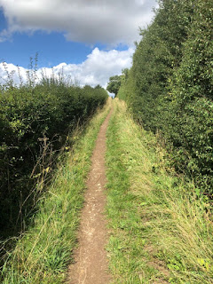
The path went next to a field & a hedge
Then it went next to the woods
Then on a narow path with a sign on it.
Then I came to White Lane, and crossed it and went through a wooden gate onto another track.
I then went on a path near & through some woods, towards Freemantle Farm.
It was a lovely path going through the woods, going across a short field and entering another wood.
The signpost had finger posts showing the way across the field and into the next wood.
Then the walk went through these woods, and came out onto a chalky track, and went up a hill.
A sign on the corner at the top, pointed me to the left, , so I walked along the top of the hill, with a view across the hills of the Tv mast near Kingsclere.
Then I walked down a chalky track to Freemantle Farm entrance, where I turned left, went up a slight hill, then went right into a footpath entrance.
Going up the hill on a chalky track.
The entrance to the path has a signpost and the walk goes eventually across a farmers field.
I then walked along a grassy path, to the farm buildings, where the path went next to them, and came out onto a tarmac lane, where I turned right and walked up a hill. I was now in the village of North Oakley.
Walking up the tarmac lane in North Oakley.
The lane turned left, and I went straight on along a chalky track.
Then at a point where a sign pointed the route to the right, I turned right and walked along the Wayfarers Walk as indicated on my OS map.
I was now walking along a very pleasant path towards Walkeridge Farm and Meadham Lane.
The path crossed another path that goes between Hannington and Tidgrove Warren Farm as these photos show-the sign telling me about this path, and looking left as it goes uphill towards Hannington.
I then walked up hill on the same Wayfarers Walk
I then walked past a field on the left with some caravans in it.
I then came to a tarmac lane next to Walkeridge Farm which I passed.
Soon I came to a sign about the farm on the left and the caravan park as well.
The lane met Meadham Lane, which goes right and left, left downhill towards the B3051, road that runs between Kingsclere & Overton & Whitchurch, and Meadham Lane goes right uphill towards Hannington.
I looked at my map,
and saw that the way to the Wayfarers walk was to the left, so looked in that direction and not far away I could see a fingerpost and path going to the right.
I then walked along a path that at first went up hill, then down again, with a lovely view ahead of the gallops on White Hill.
At the bottom of this hill, the Wayfarers Walk crosses over the B3051, but I was going to Kingsclere, so I looked at my OS map to check out the route.
I saw that I was on the Wayfarers Walk, and was going to turn right along a dotted footpath on Stubbington Down. I was going to turn right, on the footpath near the the word Pale of Park Pale, walk up a slight hill, then left, down another dotted path, to reach Cottington's Hill, and walk along the side of this hill.
I saw a footpath sign indicated a route alongside a field on the right, I walked along this footpath.
I could see the TV mast as I wa s walking towards it, because it's at the top of White Hill, above Kingsclere, so I was near that place now.
When I came to a metal kissing gate on the right-hand side,
I turned right and went through it, and up a slight hill, then left alongside a fence and downhill to another metal kissing gate.
So on the top of the hill near this metal kissing gate I checked out my route on my OS map, and saw I was going walk along the side of the hill, then down an angled path, then along a footpath towards Kingsclere centre as this map shows.
I went through the gate, turned right, and followed the sign on the wooden post next to the gate.
I then walked along the side of the hill in some woody pieces of path,
that did a very short climb, and then carried, going past the TV mast
Then the path goes along the top of the hill,
and eventually comes to a path that is coming up the hill at a pleasant angle.
I then turned left, and walked down this path, that goes down the side of the hill, through another kissing gate.
and at the bottom of it where there was a sign
then I went left, and walked towards a tree lying across the path
then right and down to a path beside a hedge and to the right are a horse gallop place.
Then I followed the path that goes next to a hedge, and saw a racehorese galloping on a gallop place to the right
The path I was on, goes across a horse path, and then down and up a path towards an escarpment ahead of me.
Then I went through a gate, and up some steps, and up a narrow path,
then I walked up a long flight of steps, about 40 of them I think, and onto another narrow path.
Then I went through a metal gate, then up and down a football field towards a wooden gate.
I walked through this gate, and turned right, and walked down a narrow path
The path went onto a street called Anchor Road, that lead past a free car park on the right hand side
I walked past this car park, then right along Anchor Yard, towards the road called the George Street.
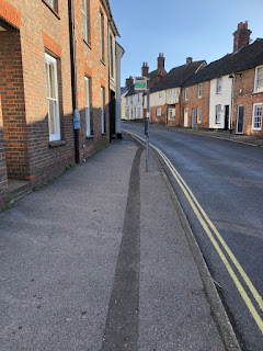
At George Street, there are 2 bus stops, the one on the left is the bus stop for buses to Newbury as these photos show.
If you walk across the road, which I did, because I was going back to Basingstoke, and then turned right, and walked a few paces to the bus stop.
So now my walk was over, and the last few bits of the walk from the top of the hill I will always do again, though there maybe some changes in plan depending on the weather, the surface of the ground, be or wet or dry and how fit I am feeling.
I had walked that day 13.08 miles and gone up and down 1200 feet.















No comments:
Post a Comment